
In part 1, I wrote an overview of our 6-day long backpacking trip on the Sawback Trail, in Banff National Park. This installment is about the first 3 days of the hike.
Day 1
Distance hiked: 18 kms
Elevation gain: 250 m
Camped at: Mystic Junction Fm19
We spent the night at a frontcountry campsite near Banff, but had trouble adhering to our initial plan of waking up at 7 am: it was frigid and still quite dark when our alarms went off. Luckily, buses from Lake Louise to Banff run every hour, and we had a relatively short day ahead of us, so we went easy on ourselves.
After the late start and dealing with the through hike logistics, we finally reached the Mt. Norquay ski resort at 1.30 pm.

We walked through grassy ski slopes trying to locate the official trail. First, we came across a wedding party on a barren blue run and then shortly after, a grizzly bear; we hadn’t even left the ski resort and were already in the wilderness.
The bear registered our presence but luckily, was more interested in the grass than us. After failing to scare it off, we took a detour through the ski slopes. It watched us from a distance but stayed focused on the grass. The rest of the day was uneventful. We did not see a single soul, and most of the trail was through the forest with minimal elevation gain.
Once at camp, the cloudy day gave way to evening showers. I might have had trouble sleeping, with the grizzly encounter still on my mind, if not for the rain. The constant pitter patter of drops on the tent fly managed to drown out my paranoia and lulled me to sleep.
Day 2
Distance hiked: 17 kms
Elevation gain/loss: 300m/350m
Camped at: Flint’s Park Cr31
The rain lasted well into the morning. We got another late start to the day, packing up and finally setting out at noon.
The trail continued through the forest, which is extra miserable when everything is wet. Eventually though, it opened up into a meadow, with sweeping views both behind and ahead of us. The sun peeked through the clouds intermittently, which cheered us up a great deal. The trail was extra wide, as we had merged with the equestrian trail by that point.


We decided to explore a parallel route that climbed up from the meadow and went past Rainbow Lake. A steep climb took us to a viewpoint, but according to our GPS, we were quite far from both the trail and the lake. We had followed a pretty obvious path the entire way, so this turn of events really stumped us. We spent an hour backtracking and looking for missed turn-offs, then gave up and had lunch at the viewpoint. The sun blessed us with its presence, and we took the opportunity to air out our tent.
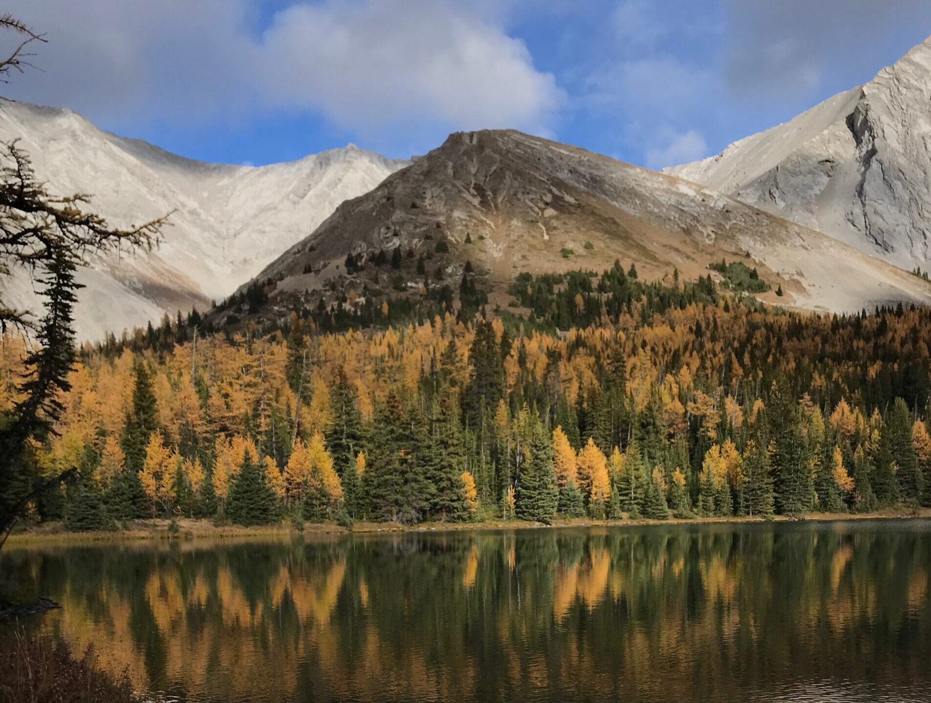
After lunch, we pressed on, and within minutes, came upon Rainbow Lake; turns out we hadn’t missed it, it just lay ahead of us. My guess is that the location of the trail in our maps app was incorrect.


Despite just concluding a long lunch break, we decided that the lake deserved another halt because it was just that beautiful. The sun was out and lighting up the golden larches along the shore. The trees were practically glowing.
From there, the hike down to the campsite was pleasant. We followed some kind of a ridge line between the Forty Mile Creek valley and the Vermillion Range. At Flint’s Park, we first arrived at a horse campsite, complete with locked up horse sheds, a warden cabin, piles of firewood and picnic benches overlooking the creek and mountains beyond. Once again, there was nobody there.
The hiker campsite was still 0.5 kms away, but we decided to have dinner there in the lingering rays of the setting sun.


If the equestrian campsite had been stunning, the hiker campsite was no less so. All the tent sites, bear lockers and food prep area were along the Cascade River and for the second night in a row, I fell asleep to the sounds of water.
Day 3
Distance hiked: 21 kms
Elevation gain/loss: 730m/480m
Camped at: Badger Pass Junction Jo29
Day 3 took us to Badger Pass, which, at 2550m, was the highest point along the entire trail.
We woke up to an overcast sky again. Some soreness from the last two days had started to creep in, and the realisation that we had 4 days of this ahead of us filled me with a little gloom. Ultimately, it actually turned out to be our cheeriest day as we got much more sun than what the forecast and the cloudy morning had led us to believe. I also started to feel one with my pack, like a turtle carrying my home on my back: I could sense the extra weight with each step I took, but there was no discomfort, no straps digging into my shoulder, or fabric chafing my skin.


On our way to Badger Pass, we got one amazing view after the other. At one point we heard a train whistle reverberate through the mountains. This indication of civilisation felt very out of place; we hadn’t seen another soul since starting the hike.
The terrain became more and more rugged as we went higher, and the wind seemed to get stronger too. Soon, we were hiking through scree and tundra. It was beautiful in an otherworldly sort of a way. But if the views so far had been scenic, the real stunner lay on the other side of the pass: we descended into a valley of larches against the backdrop of more mountains and a wonderfully blue sky. The afternoon sun hit the trees and made the entire valley gleam.


Badger Pass Junction is in a valley running parallel to the Sawback Range, and in my opinion, was the most beautiful campsite so far. We’d also had the earliest camp arrival so far (6 pm), so we felt like we deserved a little campfire. Many of the campsites along the Sawback trail have fire pits, but the real challenge is finding dry wood – we carried neither a fire starter, nor an axe, nor of course any firewood. However, with some persistence and the help of our friend, the camping stove, we managed to eventually get a roaring fire going.


For the first – and only – evening during this trip, I was not immediately cold after sunset. I even managed to wash my face, which, as it turns out, would be the only time I’d do so.
Read on for the next few days in Part 3.
Pingback: Backpacking the Sawback Trail Part 3 - Beyond Trail Mix