
If you’re starting with this post, you can read part 1 here.
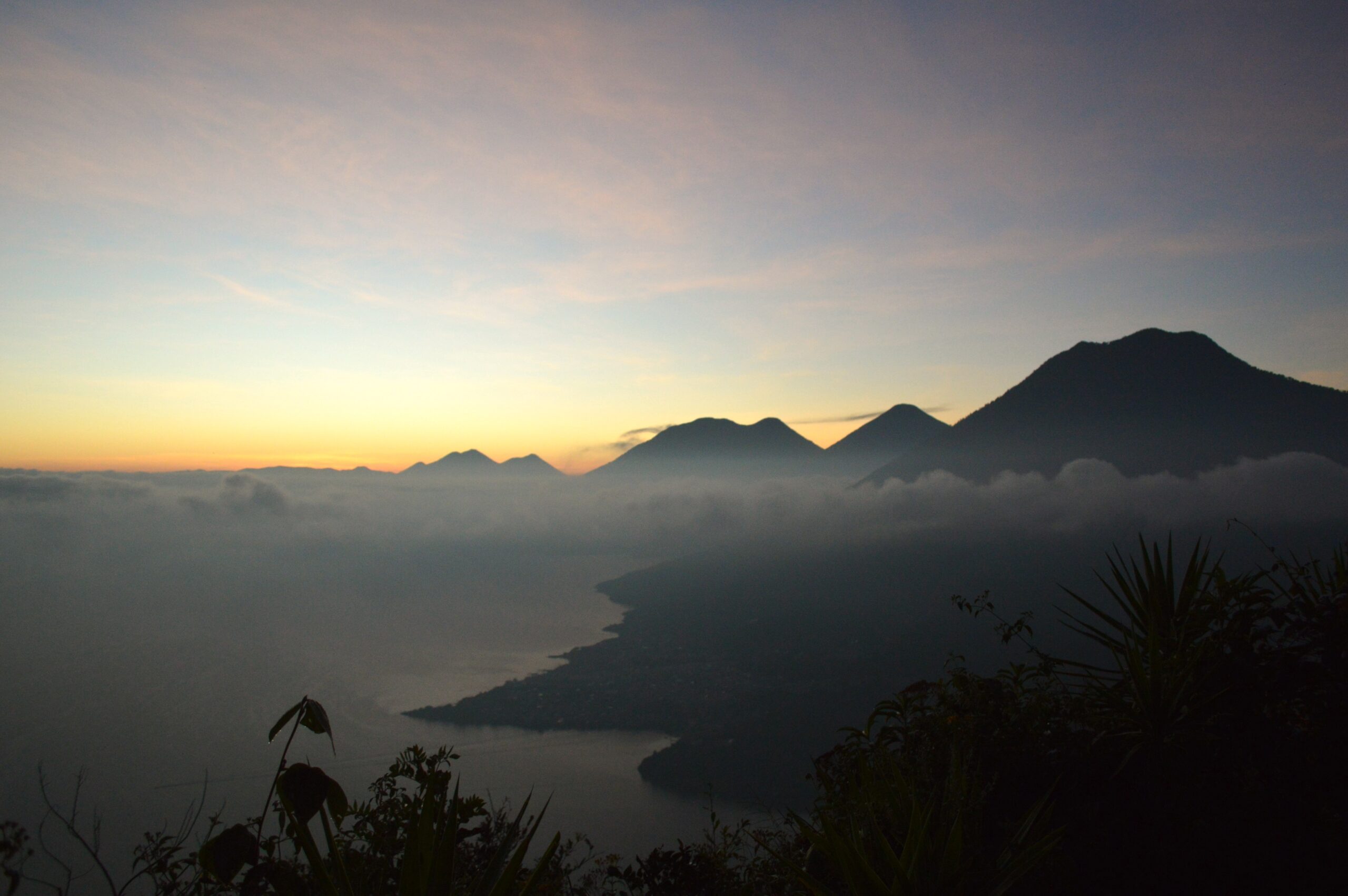
Santa Clara is nestled at the base of Rostro Maya (also called the Indian Nose), on the side opposite to Lake Atitlán. We were headed there for the sunrise. We woke up at 4.15 AM, started hiking at 4.45 AM, and after a short hike in the dark, had reached the viewpoint by 5.15-5.30 AM. Then, we settled in to wait for the sunrise.
From our vantage point, we could see the lake in front of us, and all the communities around it, lights glittering in the dark. Beyond the lake, we could see Agua, Acatenango, and Fuego poking out above a layer of clouds. Closer to us, we could also see Toliman, Volcán Atitlán and San Pedro.


Over nearly an hour, we watched in silence as the sky lightened, Fuego spewed black smoke, and the cloud layer washed across the lake to cover us entirely. Until all we could was the brilliant sun, now above the horizon, blazing down on all of us.
Our guides prepared breakfast: artisanal coffee (as opposed to the instant stuff we’d had the previous day), a sweet bun, fruit, yoghurt, oats and granola. Before sunrise, two other tourist groups had joined us at the viewpoint, but by breakfast, it was just us again.


We took in the hazy view, ate our fill, exchanged contact details, shared travel info and recommendations and got ready for the last part of the trek – the hike down to San Pedro.
The sun was shining through the trees, wildflowers dotted the edges of the trail, and surprisingly, we met not a single soul. Eventually, after 500 m of steady downhill through cornfields, avocado trees and a coffee plantation, we reached San Juan. Then, single-file along a narrow winding highway around the lake till a vacant, dusty parking lot on the outskirts of San Pedro. Here, we were reunited with all our belongings, which had been driven over from Xela.


Nick and I had booked rooms in the same accommodation in San Juan, so we headed there. The others were going to stay in San Pedro and San Miguel, and the guides were heading back to Xela. We all exchanged sweaty hugs as we bid each other farewell. And so, the 2.5 days, 2 nights, 1500 m of elevation and 42 kms through the highlands of Guatemala came to an end.
Final Thoughts
Of all the things I did and saw in Guatemala, this hike really stood out.
The sheer variety of sights and experiences throughout the trip was the highlight for me. We hiked on many types of routes: narrow, steep, hillside trails with wildflowers on both sides, flat tracks past fields and pastures, semi-paved gravel roads with the occasional pick-up truck or motorcycle, and asphalt roads and cement sidewalks across towns. We went from altitudes of more than 3000 m and chilly mornings, to 1500 m and sweltering afternoons. We saw many different landscapes too – cloud forests, remote villages surrounded by orchards, lakeside towns, fragrant wildflowers, coffee plantations, rickety bridges, rural farmlands, and semi-urban families.
I’m all for slow travel, and hiking is perhaps the slowest of all. Thanks to this opportunity, I visited places that I literally could not have visited otherwise – as they are not connected by road. I met people who spoke more Kakchikel than Spanish, and ate granadillas and macadamia nuts straight from the trees.
Currently, only two operators in Xela offer this trip, that too not every day. So it’s worthwhile to reserve in advance. It’s not something I would recommend doing without guides. You technically could, as the route is well-marked on apps such as maps.me. But the travel agencies and guides have long-standing relationships with the homestays, and it would lose some of the charm to make it a purely transactional exchange.
No doubt, it will eventually become popular and social media famous. For now, it’s still relatively unknown.
Pingback: Hiking Through the Highlands of Guatemala: Day 2 - Beyond Trail Mix