
Continuing from part 1!
Day 3, Monday
Distance hiked: 21 kms
Elevation gained / lost: 760 m / 1200 m
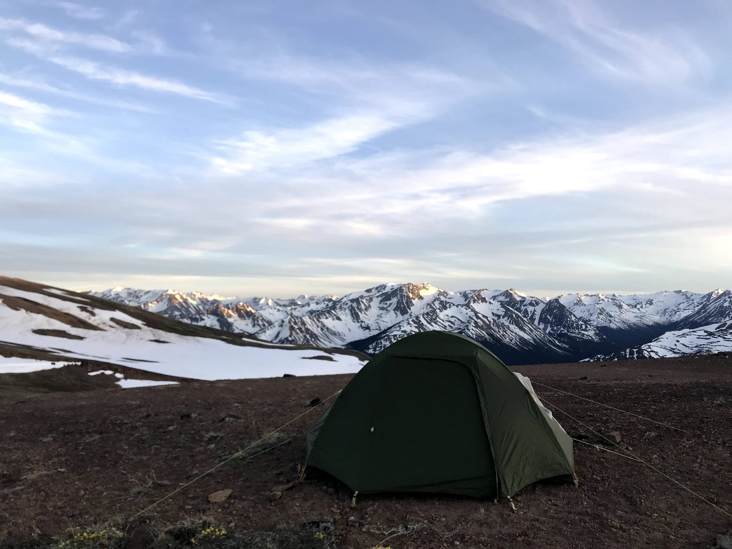
Camped at: Lorna Lake
Our plan was to hike up to Mt. Solomon and have breakfast on its summit. This took us way too long to reach, because we went off in the wrong direction initially, halfway up an unnamed peak. When we finally reached it, we were rewarded with views of Warner Pass, Lizard Lake and a few other peaks.


Back at Deer Pass, we packed up and got ready to head to Lorna Lake. We descended 760 m over the first 5 kms, towards Tyaughton Creek. This side of the pass there was still a lot of snow, and quite a bit harder to tell where the trail is going.
Tyaughton Creek is where our creek crossing woes started. The trail literally headed straight into the creek, and picked up on the other side, but it did not look crossable. Luckily someone had constructed a bridge using deadfall a short distance away, so we bushwhacked our way over and crossed it that way. All of this made our going rather slow. We were still some distance away from where the Lorna Pass Trail started.


But first, we had to eat. It was a very hot day, so we took a much-needed dip in the ice-cold waters of the creek, charged our phones, and ate some lunch. I had (cooked but plain) pasta leftovers with some vegan cheese and an olive oil, garlic powder and pepper flakes sauce. It was a more flavourful mac and cheese situation, if you will.
Ahead of us, a decision needed to be made: the Deer Pass trail forked into Lizard Creek Trail and Mid-Tyaughton Creek Trail, converging a little distance away. Which route was better? Both had multiple creek crossings as per the map, but there was no way of knowing their conditions. We decided to avoid the elevation gain and took the Lizard Creek Trail. So far, we’d been able to cross most creeks without taking our shoes off, but that good fortune was not to last. Crossing after crossing, spaced about 15 mins apart, slowed our progress down even more. Each time we had to take our socks and shoes off, and wade into waters cold enough to numb your feet instantly. Thankfully it was a hot day, otherwise this experience would have been much worse!
Halfway till the two trails converged again, we had to cross Tyaughton Creek again: here the water came up to my knees and the current was very strong. Felix and I walked side by side, which turned out to be an excellent idea because at one point I was knocked off my feet, and without Felix to fall/lean into, I’d definitely have been carried off by the creek.

By the time we reached the Lorna Pass junction, we were seriously considering if we should leave that section for the next day. It was getting to be nearly 5.30 pm, and that was just the downhill bit. We still had 10 kms ahead of us.
The original plan had been to keep the next day as a rest day, and with daylight on our side, we decided to go for it. We finally reached our destination at 8.40 pm. We had started out for Mt. Solomon at 7 am; that now seemed like many days ago.


Dinner was khichdi, a dish made of rice and lentils.
Day 4, Tuesday
Distance hiked: 0 kms
Elevation gained / lost: 0 m
Camped at: Lorna Lake
Rest day. We saw not a single soul this day. Except for each other, I mean.


If we had worried about getting bored, we needn’t have: the day whizzed by. We bathed in the lake, built big fires, experimented with a cake/pancake/cookie mix, played cards, did a spot of laundry, and whittled a wooden spatula.


Dinner was by Felix: mashed potatoes, some kind of a sauce, and a “salad” made of hydrated dried vegetables and a vinegar and olive oil dressing.
Day 5, Wednesday
Distance hiked: 19 kms
Elevation gained / lost: 900 m / 1350 m
Camped at: WD Trail junction
Fully recharged from a whole day of doing nothing, we started out early. The bugs, that had laid low the previous day, really kicked it up a notch. So we gulped down some coffee, packed up, and headed out. At Lorna Pass, we dropped our packs and made a short detour towards Trail Ridge Peak.


Incoming dark clouds and a drizzle drove us back to the pass, but miraculously cleared right after. So we had a lovely breakfast with a view, and started off again.


We hiked on through alpine meadows full of wildflowers, soon descending back into the tree line. In one such meadow, we saw … a GRIZZLY BEAR! It was a fair distance away, and it seemed unbothered by our presence. After 2 mins of checking us out, it had gone back to sniffing flowers.
At lunch-time, we ran into two Tyax Adventures employees, who’d horse-packed their way in. They were getting the camp and trails ready for guests: their work clearing the trails of deadfall was evident as we hiked on. Most crucially, we also got some beta from them about the creeks: there were about 5 crossings ahead of us, with Tyaughton coming up past the horses’ bellies… not good.
When we reached that important point, it became very clear that there was no way we could cross it. In fact, the creek zig-zagged across the trail, meaning that we would have had to cross it 4 times, only to return to the east of it. There was a scree slope with a faint trail right above it, presumably the route of choice for some backpackers, with the aim of avoiding the crossings altogether. But the slope was too steep, the scree too loose, and the trail too narrow. The only option seemed to be, to climb to the top of that slope, cross this entire section with the creek crossings, and descend back down to rejoin the trail. So that’s what we did: 250 m up and down, bushwhacking the entire way.
With that detour, we were pretty close to dead, so we changed our plans a bit. Instead of going all the way to Spruce Lake, we’d instead stop where the Mid-Tyaughton Creek Trail split into WD Trail and the Lower Tyaughton Creek Trail. There was apparently a spanking new campsite there, complete with a bear cache, picnic table, fire pit, and even lots of firewood! Another night, another campsite where we were the only ones.
Dinner was a Thai curry with couscous. Seemed well-deserved after the long and tiring day.
Day 6, Thursday
Distance hiked: 5 kms
Elevation lost: 140 m
Camped at: Spruce Lake
Practically a rest day. We hiked 5 kms to the Spruce lake campground, and then just hung out there all day.
In the morning we were greeted by some BC Park rangers, who were checking out the site while we packed up. We learned more about the park from them, including the fact that all those treacherous creek crossings are nothing more than a trickle later in the season. Yes, even Tyaughton Creek, which was hard to believe.


Spruce Lake is the campsite in the Chilcotins. Not only is it the biggest, with room for about 20 tents, but it’s also pretty spectacular: most people staying just a single night aim for this, along with lots of bikers doing day trips into the park. There were multiple firepits and picnic tables strewn around, with firewood stacked up neatly nearby. This was the first (and only) night, that we had company in the campsite.
Dinner was a Moroccan couscous dish with raisins and nuts.


Day 7, Friday
Distance hiked: 16 kms
Elevation lost: 550 m
Camped at: Pemberton
Hike out day! We took the Gun Meadow route out because we hadn’t had enough of meadows and wildflowers. We didn’t know it yet, but there was a heat wave upon us and it was not a pleasant time in the sun; the hike out felt never-ending and long, and we were glad for the small streams along the trail, where we stopped to splash our faces and drink water.

It was also eerily empty: we’d taken Gun Creek Trail on the way in, and had seen so many deer, but on the hike out that stretch had nothing. Even the wildlife was hiding in the shade, it seemed like.
Finally around 3 pm we were back where we’d begun: an overgrown parking lot. We jumped straight into Jewel Creek to cool off.
Pingback: Backpacking in the South Chilcotin Mountains Part 1 - Beyond Trail Mix
Pingback: Backcountry Bartending: Cinnamon Old-Fashioned - Beyond Trail Mix