

If you’re starting with this post, you can read part 1 here.
Day 5
From: Tyndrum
To: Kingshouse
Distance hiked: 30.5 kms (GPS)
This was our longest day on the West Highland Way — 30.5 kms, albeit on a straightforward trail. Our start was a little delayed because the village grocery shop only opened at 9 am, and we needed to resupply for the next few meals.
Around 9.30 am, we set off at a good clip, reaching Bridge of Orchy by noon for a lunch break. This was a third of our way in, which sounds like progress until you realize that we had more left to cover than what we’d done the previous entire day.


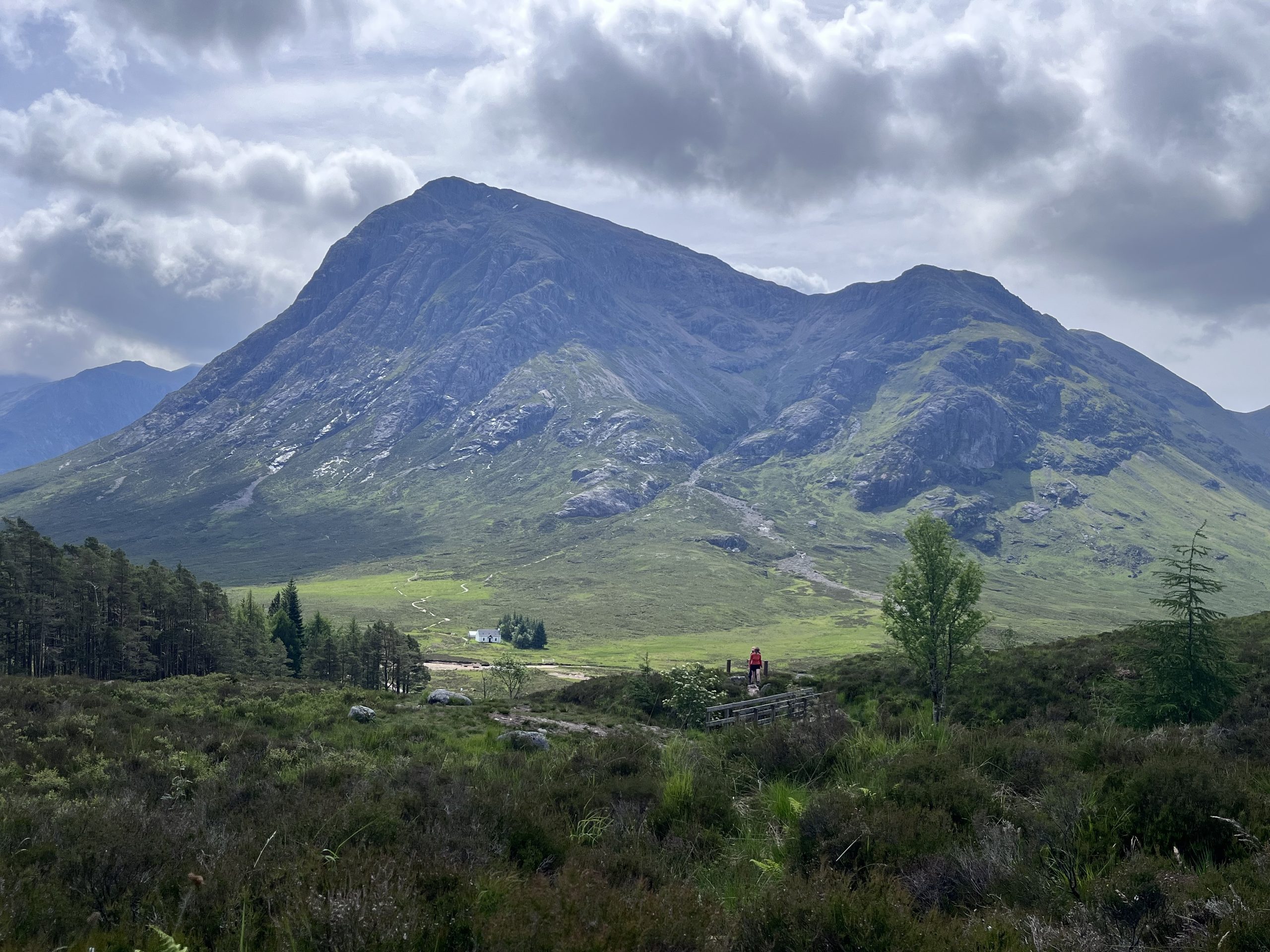
Keeping breaks short and pace consistent, we kept going. This was our longest day, but also the most beautiful. The sky was clear, temperature rather warm for the first time, and with hardly a tree in sight, we could see the highway from many kilometres away. We were treated to sweeping views of the Rannoch Moor while the mountains rose up all around beyond that — now this, truly, was the Highlands.
After a building called the Forest Lodge, the trail followed an old cattle droving track. The gravel on it, originally for the benefit of their hooves, started to take a toll on ours. Furthermore, freshly resupplied, our packs were again heavy and weighing us down.


We tried not to take too many breaks despite all of this, and soon enough, the Kingshouse Hotel came into view. It is a stark looking building, surrounded by a thicket of trees (unusual for the moor here), visible from incredibly far away. It lulls you into thinking that you’re nearly there, but as you keep walking, you realize: you’re still 7 kms and more than an hour away.

Here the trail sloped gently downwards, bypassing the Glencoe ski resort. I’d spotted the chair lifts a while back and had been trying to spot the runs, but of course, since there are no trees, the runs are not very visible!
We reached Kingshouse at 6.15 pm. This building complex has a fancy main section for hotel guests, an overpriced restaurant and bar, and then a little distance away, what looks like a shed, for the bunkhouse. But luckily both get the same views. The tree-less moors and mountains felt so lonely, broody and desolate. A far cry from the rolling hills and sheep-filled meadows of the past few days.
After a comforting dinner of instant noodles with vegetables (chopped with a butter knife and dinner plate) and vegan sausages (grilled in the toaster), sticky toffee pudding and whisky flight at the hotel bar overlooking the sunset, we were excited to put our sore joints and muscles to bed.


Day 6
From: Kingshouse
To: Kinlochleven
Distance hiked: 16 kms (GPS)
I tossed and turned all night — my hips and shoulders were so sore, that laying on either side was uncomfortable. I feared I did not get much sleep at all.
Yet miraculously, by morning, all the aches had somehow melted away!
The bunkhouse stay included a breakfast: Scottish-style, but without the haggis. I enjoyed taking my time savouring each bite.
Today would be our shortest day on the trail: 14.5 kms (official), and we had accordingly slept in and taken it easy. We headed out at 10.30 am with another glorious day ahead of us.
This time, as if to make up for the previous day, we took breaks even when we didn’t need any. Just to soak in the views.
From the hotel, we climbed 250 m to the top of Devil’s Staircase, which was our highest point on the entire trail. And the views were splendid! Sweeping, rugged mountains and valleys. At the top, right before the descent, there was a side trail to a peak (Beinn Bheag, 616 m). Since we had all the time in the world today, we went to check it out. 360 degree views and a glimpse of a lake called Black Water awaited us at the summit. These were true mountains here, some of the highest in all of UK, at close to 1000 m.


From there till Kinlochleven was a somewhat long, boring, rocky trail that eventually became paved around 1.5 kms from the town centre. It was a steady downhill the entire way, taking us into lower and lower elevations, until we were back among lush green forests and trees. Lovely in its own way, but nothing like the desolate Rannoch Moor.
Kinlochleven was supposed to have a Chinese takeout spot and we were really looking forward to dinner there. But turns out it is closed on Mondays (again, with losing track of the days!). Luckily the village was big enough to have a proper grocery store with reasonable prices, and our bunkhouse came with a kitchen, so we cooked a veggie-heavy lentil bolognese and stocked up for the days ahead.


Day 7
From: Kinlochleven
To: Glen Nevis
Distance hiked: 23 kms (GPS)
Last day on the West Highland Way — almost! How time flies. It had felt like quite an undertaking when we started out, one full week ago. But here we were, ~130 kms north, with only a little bit left to go.
I felt lazy leaving Kinlochleven — my map was showing me that we only had 16 kms to go, but I found out later that it had used the most direct route. As per the official trail we had 21 kms today. And right at the start was a big climb, as we left Kinlochleven behind in the valley. It had so far been the largest village on the way, and as the trail rose higher and higher, we got great views of it.


After the initial climb, it flattened out and followed a valley as it curved north towards Fort William, the northern terminus of the Way. The initial ‘glen’ / wilderness soon gave way to managed forests and pastures. On the way we passed an abandoned stone cottage, which was quite a contrast against the lush green hillsides.


Closer to Glen Nevis, the trail turned into a paved path. Here we did a short detour to the ruins of an Iron Age fort called Dun Deardail. Another mini peak bag.
The fort wasn’t super obvious. It had been covered by overgrowth for a very long time. But we got splendid views of Ben Nevis, Glen Nevis and Fort William in the distance.


The last 5k of the day involved bushwhacking through an overgrown field, as we left the WHW and descended to Glen Nevis. The WHW continues on at a higher elevation, bypassing the village entirely. My app said there was an offshoot trail, and there certainly was at the start, but it soon disappeared. Hence the bushwhacking.
We reached the youth hostel where we would be staying for the next 2 nights, around 6.30 pm. Thanks to their lovely kitchen, we cooked up some instant noodles, leftover vegetables and some more lentils. Someone had left a box of fancy mixed mushrooms on the communal shelf, so we threw that in too. But later, while eating, we found out that that was an accident. Oops!
Day 8
From: Glen Nevis
To: Glen Nevis
Distance hiked: 14.5 kms (GPS)
Ben Nevis day!
I’d done some prior research into an alternate approach called the CMD route, but on the morning of, K expressed not wanting to stray off the beaten path. It had been raining all night and early morning, visibility was expected to be low, and one of her boots had started to fall apart…
So we had a much more relaxed start to the morning. The included “Wee Breakfast” offered us toast and jams, coffee, apples, yoghurt, a large variety of muesli/cereal and some fruit juice. After tucking in and getting ready (slowly) for the hike, we finally headed out at 10.30 am.
The “Pony Track” to the summit starts out as a wide, stone-inlaid path, with rocks placed as steps etc., and turns into a more primitive, loose rock/gravel trail. It’s a bit of a slog, as it is a constant climb from near sea-level to the very top, at 1345 m.


Along the way, the clouds kept parting to give us glimpses of Fort William, the hills beyond it, and some distant lochs. I don’t know how it compared to a typical day but the trail felt pretty busy.
Around 900-1000 m, it suddenly became very very windy. And as we climbed past 1200m, the visibility dropped as we were enveloped in clouds. We also needed to navigate 2 snow patches, but nothing crazy, as they were both well-trod.
Soon, large, nearly 6-feet high cairns loomed out of the shadows to keep us on the safe route. One side of the mountain is a sheer cliff.
At the very summit, it was rather miserable. The wind whipped the clouds around us, making everything wet even though it wasn’t raining. We took a few summit pics, ate a gummy candy to mark the ascent and quickly turned around and headed back. We spent 10 minutes at most! You could see shadowy figures of other hikers hiding behind the cairns, huddling for warmth. In hindsight, it was a good call to not do an exposed ridge walk under those conditions.


The descent was quite boring. We got more views here and there, but the incessant impact on the knees as we made our way down was getting tiring. At least our packs were light!
All in all, it was a quick trip: we were back at the youth hostel by 4.30 pm.
Day 9
From: Glen Nevis
To: Fort William
Distance hiked: 6.5 kms (GPS)
Officially the last day of WHW!
We left at 8.30 am, expecting to hike for 1-1.5 hours till Fort William. After a couple of wrong turns and our last glimpses of some highland cows, we finally got back to where we’d left the trail and picked it up from there.
The new High Route contouring around Cow Hill gave us nice views of Fort William, and kept us away from the main road for longer. Till finally it spit us out a few blocks from the trail end marker.


I’d thought navigating within the city would be annoying, but it was surprisingly well signposted all the way to the bronze statue at Gordon Square. We clicked a few celebratory pics, browsed some souvenir shops, got our final stamp of the trail and went to grab a bite at the all-vegan Wildcat Cafe.
And that’s it. The only thing left for us now was to catch the bus back to Edinburgh and spend the night in the city. The next morning was K’s flight home.