

If you’re starting with this post, you can read part 1 here.
Day 1
From: Milgavie
To: Drymen
Distance hiked: 21 kms (GPS)
We started on the West Highland Way at 11.45 am from Milgavie (pronounced “Mill Guy”).
K’s flight had landed at 9 am in Edinburgh. After a bus to Glasgow, train to Milgavie and a not-so-quick shop for supplies later, we were off. With the heaviest our packs were ever going to be.


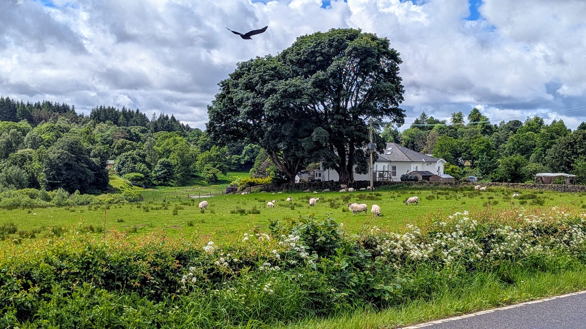
The first day’s stretch was a gentle introduction to the trail for us. We got spells of rain followed by intense sun that allowed us to fully dry out in between. We saw rolling meadows and walked through pastures full of sheep and cows. We crossed a forest of some kind that reminded us both of Lynn Valley, but with different trees.


Through most of the day, the trail was relatively flat and wide enough for both of us to walk side-by-side. We were able to make quick work of the 19 km (official) / 21 km (Garmin/GPS) and got to chat a lot. Occasionally, we saw other hikers/walkers, but no one who looked like they’re doing a multi-day trip. We crossed a handful of bikers too.
At Drymen, we checked into our hotel around 6.30 pm. It was a fancy one with amenities like a hot tub, pool, sauna and steam room. We had a couple of hours to kill until our dinner reservation, so we made good use of the hot tub. I only dangled my feet as I could not remember the precautions for pregnancy.
Afterwards, we walked over to the Clachan Inn — one of Scotland’s oldest licensed pubs, based on a date of 1734 — and got ourselves a hearty dinner. Despite being ancient, the establishment had a separate vegan menu and various alcohol-free options like a “botanical spirit” (gin). Of course, they also had a ton of Scottish specialties and a long list of local whiskies. I sampled some cullen skink (akin to clam chowder) and a whisky from the local distillery, from K.


And so after the long day with our heavy packs and now full bellies, we were ready to collapse into our beds. Especially poor K, who was likely terribly jet-lagged.
Day 2
From: Drymen
To: Rowardenan
Distance hiked: 27 kms (GPS)
My knees are sore. The pack felt heavy all day even though K had taken a lot of the food weight off me. Much too late, I realized it’s because my pack was sliding down and not resting on my hips. Likely due to all the rain gear we wore. Shimmying it up every so often made a world of difference, but some damage had already been done by then.
We started today with a downpour. It was forecast to rain all day, lightening up to a drizzle in the afternoon.
From Drymen, we headed up to Conic Hill. The trail rose gently uphill through meadows and pastures, eventually giving us glorious views of the loch. Or so it would have, if everything wasn’t shrouded in mist and clouds. It was hard to stop and take in the views while getting pelted with rain and wind. This was the damp, dreary Scottish countryside that we’d heard a lot about.

On this section, we saw a lot of people. Some of them were coming from Drymen like us, but many were just going up Conic Hill for a short hike from the nearby village of Balmaha.
I found the uphill quite hard and needed to stop every so often to catch my breath. I used this time to take the views in mentally, as I sure wasn’t going to pull out my camera in those conditions. But the trail was really well-developed, and hiking it in the rain wasn’t too bad. It bypassed the true summit though, and in that weather, I did not feel like prolonging my exposure, so Conic Hill remained unbagged.
At the Balmaha Visitor Centre, I discovered the rain had gotten all the way into my bra and I was feeling cold and miserable. It had been fine while we were on the move, but we’d stopped to eat lunch and the chill had set in. I ate my sandwich while shivering violently, and we decided that this situation called for an extended coffee break at Balmaha’s only coffee shop, St. Mocha.
We spent a little over 1.5 hours there, getting warm fluids in, drying off, and in my case, changing. A lot of people seemed to have the same idea: the cafe was full of faces we’d seen on the trail, wet rain jackets and pack covers sprinkled around the cosy space like exotic wildflowers.
Eventually when K said she was going to fall asleep if we don’t start moving soon, we reluctantly left St. Mocha’s warm confines and trudged on towards Rowardenan, our stop for the night.


The Highland Boundary Fault crosses Balmaha, so from here, we were officially in the Scottish Highlands!
The rain was now only a drizzle, the trail relatively flat again (at least until near the end, where we were met with a few surprise uphills) and moods considerably more chipper. We really enjoyed the sections along the loch, and took a gummy candy break at one of the many little beaches we passed on the way. This reminded us both of the West Coast Trail. We scouted a ton of great camping spots along the way. Scotland is known for its freedom to roam laws, but worth noting here is that between March and September, wild camping isn’t allowed in the Loch Lomond area as it’s a national park.

Day 3
From: Rowardenan
To: Inverarnan
Distance hiked: 24 kms (GPS)
The bunkhouse at Rowardenan appeared to be a large converted house, and thus had a lovely homey feel to it. It felt extra homey when the manager, Alex, greeted us and then promptly told me to slow down for the section tomorrow. I was rather taken aback. Had I given off the sense that I’m particularly fast? I certainly did not feel that way after huffing and puffing my way up Conic Hill earlier. But then it dawned on me that K had made a note about my pregnancy while booking, and despite not checking or looking at IDs, Alex had somehow remembered that!
This morning K said she was awoken last night by sounds of someone retching. Right as she said that, one of the other hostel guests came downstairs asking for food poisoning medication for her hiking partner — the one K had heard! I only had an Imodium to offer. Turns out, they had filtered some water along the way. We had seen signs all along Loch Lomond saying not to drink the water even post filtering, and now I knew why! I’d brought a filter for emergencies, but I sure was not going to use it after this.
Today’s stretch is supposed to be the trickiest. After Alex, the hostel manager’s warning, her ominous advice to “fall to the right if you slip” and mention of a ferry option “in case we did not want to keep going after Inversnaid”, we were a bit concerned about what lay ahead of us.
Up to Inversnaid and its glorious waterfall however, the trail resembled an old forestry road — wide, gravelly, with the occasional pothole, but I’d driven on worse than that. We quickly covered those 12.5 kms in about 2.5 hours.


After Inversnaid, there were a lot of rocky, rooty sections as the trail hugged the loch. The last few days of rain had brought on a lot of mud. But K and I were both used to terrain of this sort, and with help from our hiking poles, it wasn’t much of a challenge. The going was slower, and we paused often to admire the views. The entire time we kept waiting for the “treacherous” bit, until around 4 pm, we finally reached Doune Byre bothy, just 5.5 kms from our destination.


Bothies are free-to-use primitive wilderness shelters, and we had been considering staying in this one for the night. Unfortunately people recommended not to rely on them, so we had given up and made alternate arrangements. But this bothy, even this late in the day, had not a single soul in it! It wasn’t the most glamorous, with its overflowing trash bin (people did not follow Leave No Trace apparently) and soot/ash covered walls, floors and ceilings, but it would have been beautiful to spend the night in the (semi-) outdoors.


After thoroughly inspecting the bothy, we moved on, reaching Inverarnan around 5.30 pm. We had plenty of time to rest up, shower, enjoy a nice dinner and catch up on sleep. They had live music that evening, which was a welcome surprise.

At Inverarnan, we were staying at the Drover’s Inn. It is reputed for its ~300 year old stone building, low, beamed ceilings and various stuffed animals. It’s another one on the list of the oldest pubs in Scotland (1705!) and back in the day, provided food and accommodation to cattle/sheep herders (“drovers”) on their long journey to various markets.
Not anymore though! Now, primarily catering to road trippers and visitors to Loch Lomond and the Highlands, this inn had come a long way from its peasant beginnings. It was our most expensive stay on the trail! The price was mostly for the vibe and ambiance, since the interiors and ancient furnishings otherwise looked a bit dingy if you inspected anything too closely. Most of the clientele at the pub was middle-aged and older, and from their outfits and lack of fatigue, did not appear to be walking the West Highland Way.


Dinner for me, was their only vegan main — a cauliflower “steak” with veggies and fries, which was pricy for what it was i.e., a plateful of vegetables, but super delicious.
Day 4
From: Inverarnan
To: Tyndrum
Distance hiked: 20.5 kms (GPS)
My 6.30 am weekday alarm did not ring; I had forgotten it was a Saturday. Since the sun was setting so late and rising so early, I was sleeping through the morning light and could not reliably use it to tell how early or late it was. When I finally got out of bed, I realized it was 8.30!
Luckily, we had planned to leave late that day, and it felt like I really needed those extra hours of sleep.
Our most expensive stay included a full Scottish breakfast. I got the vegan version, with veggie haggis (not a fan), baked beans, grilled tomato, toast and mushrooms. It was greasy and filling and delicious. Exactly what we needed to fuel us for the day.
Today was supposed to be a short day, as the trail would again be wide and gentle. So we were in no rush at all and finally set off at 10.30 am.
We had brief spells of rain and gusty wind, but also peeks of the sun all along. The trail was gorgeous, climbing above the highway and into pastures and managed forests. The main challenge today was evading all the mud, as streams running down the hillside tended to flood the trail.


Of course we saw lots of lambs like before, but interestingly, there were also some spots of historical interest along the way — a graveyard with 4 medieval-era gravestones from the 7-8th century, ruins of St. Fillan’s priory, a “Holy Pool” or pond with medieval ritualistic significance etc. We took our time at all the spots and more, strolling into Tyndrum around 5 pm. A quick grocery shop, shower and dinner later, we were tucked into our cosy twin beds.


The journey continues in part 3.